- New

+90% in stock. Fast shipping. Free support.
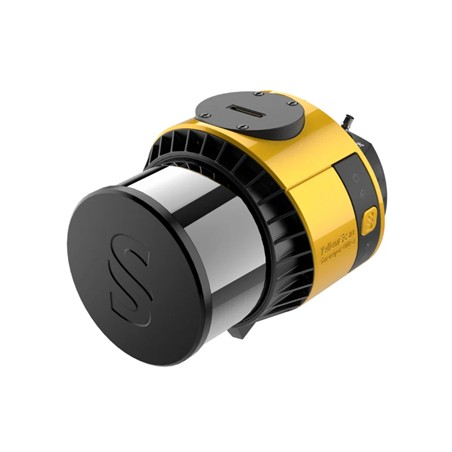
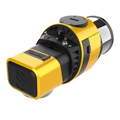
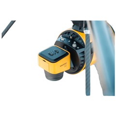
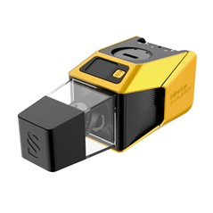
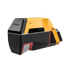
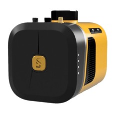
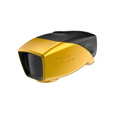
YellowScan Surveyor Ultra 3 Integrated System
Overview
With its 360° field of view, the YellowScan Surveyor Ultra marks a new generation of YellowScan LiDAR systems integrating SBG Systems’ IMU, combined with an integrated RGB camera for colorization purposes.
Combining light weight, high density, and featuring 32 beams with up to 3 echoes, the Surveyor Ultra can tackle any survey, from mobile mapping to dense vegetation penetration.
The Surveyor Ultra can be used on multirotor, fixed-wing VTOL and helicopter UAVs.
This flexibility is an asset when there are a great diversity of missions, sizes, and reliefs.
Fixed-wing VTOL for big areas to survey, multirotor for small areas or vertical sections.
When it comes to drones, the “quick release” attachment allows for easy mounting on a wide range of drones.
Two options: Gremsy or Skyport, which can be interchanged depending on the drone.
The Surveyor Ultra allows for the collection of LiDAR data not only from the ground, but for verticals as well.
It is the best option for vertical inspection applications such as buildings, bridges, coastal erosion, cliffs, and mountains.
As with all YellowScan LiDAR systems, the Surveyor Ultra follows the “Just Press the Yellow Button” philosophy.
It is designed for 3D modeling under vegetation and fast data processing.
The Surveyor Ultra now has an embedded camera (global shutter) that can be used for colorization purposes.
Handle pointclouds with YellowScan"s own, all-in-one software solution.
Extract, process, and display data immediately after flight acquisition.
YellowScan CloudStation Essential & SBG Qinertia.
All YellowScan systems are calibrated before shipment and come with a calibration certificate.
Key Features
360° Surveying & Mapping
High Point Density
Maximized Range
Easy to Use and Process
Safe Operational Range
Technology Inside: SBG Systems Quanta Micro / Hesai XT32M2X
Specifications
Laser scanner: Hesai XT32M2X
GNSS inertial solution: SBG Quanta Micro
Precision: 3 cm
Accuracy: 2.5 cm
Typ. flight speed: 10 m/s
Typ. flying height: 100 m
Max. rec. flying height: 140 m
Point density: 60 pts/sqm @ 100m AGL 10 m/s
Laser range: Up to 300 m
Laser wavelength: 905 nm
Scanner field-of-view: 360° x 40.3°
Max. data generated: 1 920 000 points/sec
Echoes per shot: Up to 3
Shots per second: Up to 640 000
Scanning frequency: Up to 20 Hz
RGB camera: Built-in 2MP global shutter
Weight: 0.98 kg (2.2 lbs) batt. excl.
Size: L 153 x W 113 x H 117 mm
Autonomy: 1.2 hour typ.
Power consumption: 20 W
Operating temperature: -10 to +40 °C