- New

+90% in stock. Fast shipping. Free support.
YellowScan Surveyor Ultra 3 & Single Camera Module 20MP
Overview
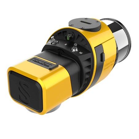
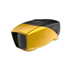
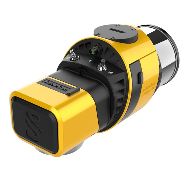
With its 360° field of view, the YellowScan Surveyor Ultra marks a new generation of YellowScan LiDAR systems integrating SBG Systems’ IMU, combined with an integrated RGB camera for colorization purposes.
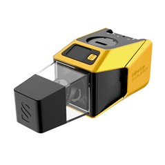
Add the Sony APS-C size Exmor™ CMOS image sensor with a BIONZ X™ processor to produce combined high-precision 20.1MP images.
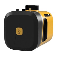
Combining light weight, high density, and featuring 32 beams with up to 3 echoes, the Surveyor Ultra can tackle any survey, from mobile mapping to dense vegetation penetration.
Key Features
360° Surveying & Mapping
High Point Density
Maximized Range
Easy to Use and Process
Safe Operational Range
Technology Inside: SBG Systems Quanta Micro / Hesai XT32M2X
Collect LiDAR and RGB data in a single flight
20 MP Single Camera Module
Sony APS-C sensor (23.6 x 15.7mm)
16 mm Focal Length
Rolling Shutter
Field of View: 71.9°
331 g
Powered by the system
Synced to your LiDAR
Easy to use
Sony E 16mm F2.8 Lens
Specifications
Laser scanner: Hesai XT32M2X
GNSS inertial solution: SBG Quanta Micro
Precision: 3 cm
Accuracy: 2.5 cm
Typ. flight speed: 10 m/s
Typ. flying height: 100 m
Max. rec. flying height: 140 m
Point density: 60 pts/sqm @ 100m AGL 10 m/s
Laser range: Up to 300 m
Laser wavelength: 905 nm
Scanner field-of-view: 360° x 40.3°
Max. data generated: 1 920 000 points/sec
Echoes per shot: Up to 3
Shots per second: Up to 640 000
Scanning frequency: Up to 20 Hz
RGB camera: Built-in 2MP global shutter
Weight: 0.98 kg (2.2 lbs) batt. excl.
Size: L 153 x W 113 x H 117 mm
Autonomy: 1.2 hour typ.
Power consumption: 20 W
Operating temperature: -10 to +40 °C
20 MP Camera Module
Weight (g): 331 (.7lbs)
Shutter Type: Rolling
Sensor Size: APS-C
Sensor Width (mm): 23.2
Sensor Height (mm): 15.4
Image Width (px): 5456
Image Height (px): 3632
Focal Length (mm): 16
Pixel Size (µm): 4.25 × 4.25
GSD at... (cm/px)
AGL 50 m: 1.33
AGL 80 m: 2.13
AGL 100 m: 2.66
AGL 120 m: 3.19