+90% in stock. Fast shipping. Free support.
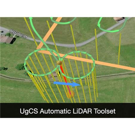


UgCS EXPERT is the premier tool for professional pilots and surveyors utilizing LiDAR technology. This perpetual license includes all Pro version features while adding an exclusive toolset to optimize laser data collection: automatic IMU calibration patterns, flight planning based on the sensor"s Field of View (FOV), and smooth cornering to prevent data gaps. With support for leading sensors (such as RIEGL and YellowScan) and 3D terrain-following capabilities, UgCS Expert ensures precise surveys even in complex geographies and offline environments.